Calgary, Alberta, Canada to Fernie, British, Columbia, Canada Printable
Map with Directions
Page 1 of 3
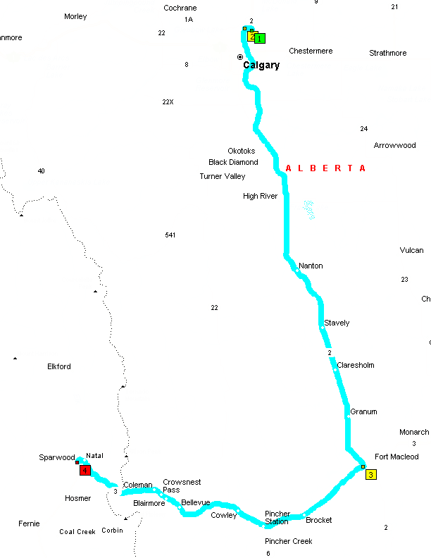
Calgary to Sparwood
Summary: 190.5 miles (3 hours, 13 minutes)
Page 2 of 3
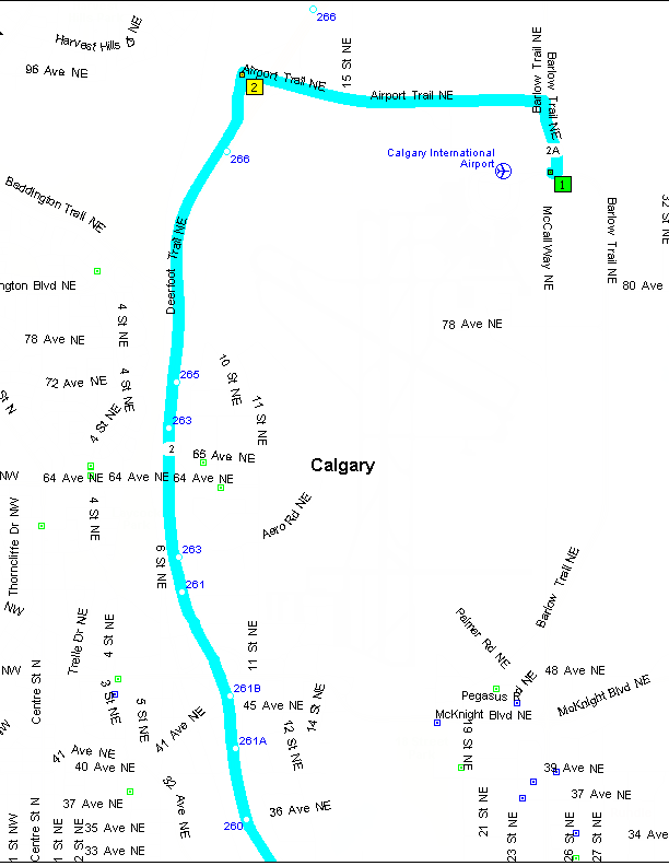
Written Directions, Traveling from Calgary, Alberta, Canada to Sparwood, British
Columbia
0.0 Depart near Balzac on Airport Rd NE (East) 54 yds
0.1 Keep STRAIGHT onto Local road(s) 10 yds
0.1 Turn LEFT (North) onto Local road(s) 21 yds
0.1 Keep STRAIGHT onto Hwy-2A [Barlow Trail NE] 0.3 mi Hwy-2
0.3 Keep LEFT onto Local road(s) 0.1 mi
0.4 Turn LEFT (West) onto Airport Trail NE 1.6 mi
2.0 Turn LEFT (South) onto Local road(s) 21 yds
2.1 Keep STRAIGHT onto Ramp 10 yds Hwy-2 / Deerfoot Trail South
2.1 At near Balzac, stay on Ramp (South) 0.3 mi Hwy-2 / Deerfoot Trail South
2.4 Merge onto Hwy-2 [Deerfoot Trail] 109.3 mi
111.7 At exit 89, keep RIGHT onto Ramp 0.4 mi Hwy-3 / Crowsnest Highway West
112.1 Keep RIGHT to stay on Ramp 164 yds
112.2 At near Fort Macleod, stay on Ramp (West) 0.2 mi Hwy-3 / Crowsnest Highway
West
112.4 Merge onto Hwy-3 [Crowsnest Hwy] 78.1 mi
177.8 Entering British Columbia
190.5 Arrive Sparwood
SUMMARY
Driving distance: 190.5 miles
Trip duration: 3 hours, 13 minutes
Driving time: 3 hours, 13 minutes
page 3 of 3
Map of area around Calgary, Alberta, Canada Airport (YYC)
Directions from Airport to Highway 22 (directions above)
Designed to print on three (3) 8.5X11 pieces of paper
Click to return to website.