Printable Map from Kalispell, Montana to Sparwood, British Columbia Canada
page 1 of 2
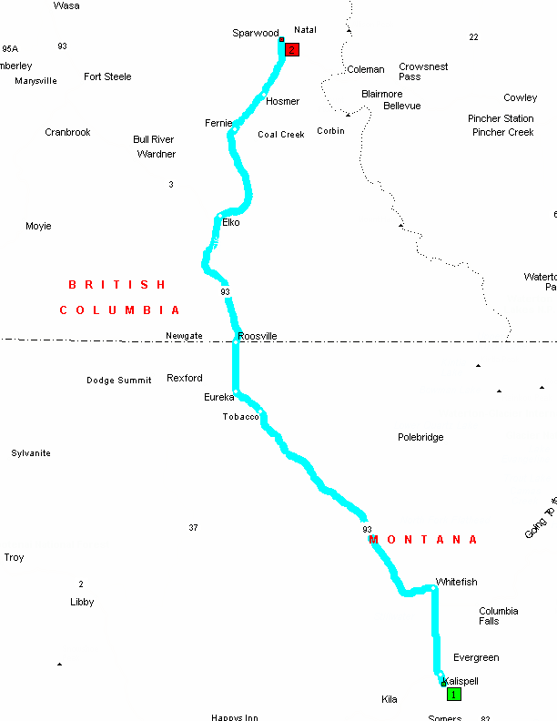
Summary: 136.5 miles (2 hours, 39 minutes)
Kalispell, Montana, USA to Sparwood, British Columbia, Canada Written Directions
page 2 of 2
0.0 Depart near Kalispell on Local road(s) (North-East) 120 yds
0.1 Turn LEFT (North) onto US-93 [Main St] 16.4 mi
16.5 Turn LEFT (West) onto US-93 [2nd St E] 59.6 mi
76.0 Entering British Columbia
76.0 Road name changes to Hwy-93 22.9 mi
98.9 Keep RIGHT onto Local road(s) 142 yds
99.0 Keep STRAIGHT onto Hwy-3 [Crowsnest Hwy] 37.5 mi
136.5 Arrive Sparwood
SUMMARY
Driving distance: 136.5 miles
Trip duration: 2 hours, 39 minutes
Driving time: 2 hours, 39 minutes
Designed to print on two (2) 8.5X11 pieces of paper
Click to return to website.